Consultation Digest 37, 25 June 2019: When is a bus/taxi/cycle gate not a bus/taxi/cycle gate and other matters to ponder.

Ever so slightly staggering news in this issue of a bus/taxi/cycle gate installed in the Athletes’ Village in Glasgow in 2014 in the hope a bus service would be introduced. Surprisingly, since the City Council does not control the buses and they never applied for a Traffic Regulation Order (so it’s never been legal!) it’s to be removed – just as a new primary school is about to be opened right next to it! (See Item 3.1)
Exciting proposals from Edinburgh and yet more patchwork 20mph schemes and speed cushions elsewhere – do read on.
Contents
Section 1: Current Consultations
- ** NEW** City of Edinburgh Council– Edinburgh City Centre Transformation, closes 28 June
- **NEW** Glasgow, Broomfield Road Traffic Calming, closes 05 July
- **NEW** Glasgow, Ladyloan Avenue Traffic Calming, closes 05 July
- Glasgow, Garscube Road, parking and loading restrictions to allow construction of 2-way cycle lanes, closes 12 July
- Glasgow, Future Policy Development of Taxi and Private Hire Car Licensing, closes 29 July
- **NEW** Glasgow (North Kelvin, North Woodside and Woodlands)(Mandatory 20mph Speed Limit Zone) Order , closes 02 August
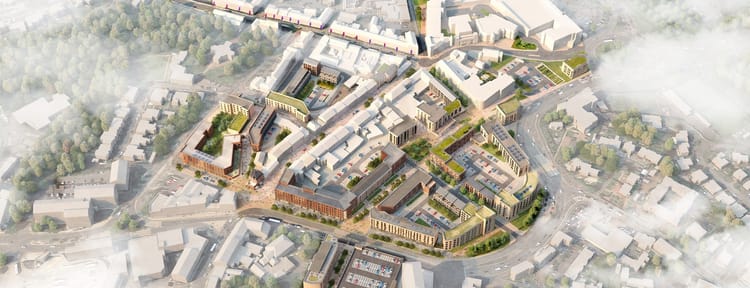
- **NEW** Glasgow, St Enoch District Regeneration Framework Public Consultation, closes 06 September
Section 2: Forthcoming Consuitations
None that we have heard about.
Section 3: Consultation Feedback
- Glasgow, Sunnybank Street, traffic calming: GoBike response and eye-watering view from the City Council
- Glasgow, Denmark Street, no waiting and loading: GoBike response
- Glasgow, University Avenue, Traffic Regulation and Parking controls: holding response
- East Dunbartonshire: Traffic Regulation Orders – (i) Car Park Charging in Bishopbriggs & Bearsden; and (ii) Westerhill Rd, Bishopbriggs Waiting & Loading Restrictions
- Glasgow, Hyndland, Hughenden and Dowanhill West: implementation of 20mph
Section 1: Current Consultations in date order for responses
1.1 **NEW** City of Edinburgh Council– Edinburgh City Centre Transformation, closes this Friday, 28 June
Do you live, work or study in Edinburgh or do you visit there regularly? If so please do respond to this on-line survey. You will be asked for your postcode but do explain your reasons for visiting the city and responding to the survey – and respond by Friday, please.
We heard about this easy-to-do on-line consultation from both Transform Scotland and CyclingUK Scotland.
Here are the words from The City of Edinburgh Council’s website:
“Our vision for Edinburgh’s city centre is ambitious and firmly grounded in the aspirations of the people of Edinburgh. The proposals build on the ‘Connecting our City, Transforming our Places’ consultation and ongoing discussions with residents, businesses, community groups and stakeholders, which called for significant change to the way the city centre operates, placing outcomes for people at the heart of future change.
The proposals are designed to prompt debate. Your feedback will help shape the final version of the Strategy and guide future project development, which would include detailed design and further consultation”.
The deadline for the consultation is Friday 28 June. To respond visit the City of Edinburgh Council consultation hub.
1.2 **NEW** Glasgow, Broomfield Road Traffic Calming, closes 05 July

Here’s a nice, stratight road and just look where it is – in the north-east of the city, where we recently responded to consultation on North-East Travel Routes from Balornock into the city centre via Springburn and Sighthill:

It’s near schools, 2 parks, churches, a bowling club, a job centre and even a shopping centre – all the sort of short journeys we are told, time and time again, that are suitable for walking and cycling. What does the City Council wish to do? Provide cycle lanes to link to the others proposed for this area and encourage people to cycle? No, they propose to put speed cushions down to slow the cars. A good move but so much more could be done. With cycle lanes next to the footways and a minimum of on-road parking allowed, the road would automatically be narrowed, vehicles would thus reduce their speed and this area could become really pleasant.
Here’s the email we received from the City Council on 14 June:
“MESSAGE SENT ON BEHALF OF ANDY WADDELL, HEAD OF INFRASTRUCTURE AND ENVIRONMENT, NEIGHBOURHOODS AND SUSTAINABILITY
Dear Sir / Madam
THE GLASGOW CITY COUNCIL, (Broomfield Road), Traffic Calming Scheme 20__
The Council propose to consider the introduction of the above named Traffic Calming Scheme and I wish to establish the views of your organisation.
Background to the proposed Scheme
The scheme is aimed at improving road safety by reducing vehicle speeds.
Roads affected by the proposed Scheme.
The list of roads affected by these proposals are:-
Broomfield Road
Details of the proposed Scheme
The proposed Scheme (as depicted on the attached plan) will comprise of:-
- 5 sets of 3x 1.8m x 1.8m, 75mm high speed cushions.
- 1 set of 4 x 1.9m x 1.9m, 75mm high speed cushions.
Please provide any comments you wish to make on these proposals within 21 days.
In the meantime, should you require any further information or clarification on any points arising from the proposals, do not hesitate to contact my assistant (name and phone no removed by GoBike)
Should the Council proceed with these proposals; I will write to you again and confirm this.
Yours faithfully“
Here are the documents referred to above: Spec and Plan
There is only 1m allowed each side of the cushions at the kerb side, not much room for bikes, particularly cargo bikes or bikes with trailers so GoBike will be approving the wish to slow down motor traffic but objecting to the proposed method of doing so. Active travel should be the first consideration in such locations.
1.3 **NEW** Glasgow, Ladyloan Avenue Traffic Calming, closes 05 July

More speed cushions are proposed for this location in the west of Glasgow, to reduce speeds near a primary school. Like Broomfield Road, this is not one of the more prosperous parts of the city, but there are amenities, again, within easy walking and cycling distance. Why isn’t active travel to the school being encouraged? Why aren’t roads near the school being closed to motor traffic at the start and end of the school day, as they are at Hillhead and Broomhill in the West End and at others in the city?

The road is perhaps not as wide as Broomfield Road, but with some thought cycle lanes could be accommodated, as well as some on-road, rather than on-footway parking, and the narrowing this would bring would slow motor traffic down. Here’s the email we received from the City Council on 14 June:
“MESSAGE SENT ON BEHALF OF ANDY WADDELL, HEAD OF INFRASTRUCTURE AND ENVIRONMENT, NEIGHBOURHOODS AND SUSTAINABILITY
Dear Sir / Madam
THE GLASGOW CITY COUNCIL, (Ladyloan Avenue), Traffic Calming Scheme 20__
The Council propose to consider the introduction of the above named Traffic Calming Scheme and I wish to establish the views of your organisation.
Background to the proposed Scheme
The scheme is aimed at improving road safety by reducing vehicle speeds around the area of St Clare’s Primary School.
Roads affected by the proposed Scheme
The list of roads affected by these proposals are:-
Ladyloan Avenue
Details of the proposed Scheme
The proposed Scheme (as depicted on the attached plan) will comprise of:-
• 4 sets of 1.9m x 1.9m, 75mm high speed cushions
Please provide any comments you wish to make on these proposals within 21 days.
In the meantime, should you require any further information or clarification on any points arising from the proposals, do not hesitate to contact my assistant (name and phone no removed by GoBike).
Should the Council proceed with these proposals; I will write to you again and confirm this.
Yours faithfully” etc
The associated documents are: Plan and Spec
The gap proposed between the cushions and the kerb is, as per the previous item, down at 1m, rather than the 1.2m, used as standard by other sections of Glasgow City Council, that does give bikes a modest bit of space at the edge of a road.
GoBike will be writing in to request a more active-travel friendly solution.
1.4 Glasgow, Garscube Road, parking and loading restrictions to allow construction of 2-way cycle lanes, closes 12 July

We published all the information about these exciting proposals for a two-way cycle lane on the east side of Garscube Road in Digest 36, Item 1.4 and our response, generally supportive, will be in our next Digest, due out on 09 July – just in time for you to add your voice to the City Council.
1.5 Glasgow, Future Policy Development of Taxi and Private Hire Car Licensing, closes 29 July

All the details of this interesting consultation were in Digest 36, Item 1.5. We have had a few comments back but we will be getting our response back in, in good time.
1.6 **NEW** Glasgow (North Kelvin, North Woodside and Woodlands)(Mandatory 20mph Speed Limit Zone) Order , closes 02 August

Yet another section of the patchwork 20mph blanket that is slowly covering the city. What a shame the Restricted Roads (20mph Limit) (Scotland) Bill was voted down earlier this month. Mark Ruskell, the Green MSP who launched it, battles on, but we are left with this piecemeal approach, unless Glasgow City Council takes some decisive action.
This proposal covers the area straddling Great Western Road bordered by Queen Margaret Drive in the west and, moving clockwise, Maryhill Road, St George’s Road, Woodlands Road and the River Kelvin.
Here’s the email that arrived from Glasgow City Council on 20 June:
“MESSAGE SENT ON BEHALF OF ANDY WADDELL, DIRECTOR OF OPERATIONS, NEIGHBOURHOODS AND SUSTAINABILITY
Dear Sir or Madam
The Glasgow City Council, (North Kelvin, North Woodside and Woodlands), (Mandatory 20mph Speed Limit Zone) Order 201_
The Council propose to consider the introduction of the above named Traffic Regulation Order.
Please find enclosed a copy of the notice of the proposed Order, relevant maps, statement of reasons and detailed report.
Details of the proposals will also be available on the Glasgow City Council website at www.glasgow.gov.uk/proposedtro .
As stated in the attached documentation, any person wishing to object to the proposed Order should send details of the ground for objection in writing to to Group Manager, Sustainable Transport, Exchange House, 231 George Street, Glasgow, G1 1RX or by email to land@glasgow.gov.uk by Friday, 2 August 2019.
Yours faithfully”
etc
The documents referred to are: the Advert, Plan, Report and Statement of Reasons.
GoBike will be supporting this but adding our usual comment that, if this is the safe way to go, why isn’t 20mph being introduced across the city?
1.7 **NEW** Glasgow, St Enoch District Regeneration Framework Public Consultation, closes 06 September

We had heard that this was on its way, as we noted last time, and now we have received this email, dated 19 June:
“Hi all,
Thank you for your responses during the Broomielaw DRF consultation.
Public consultation is now underway for the St Enoch DRF and we would like your input.
Please find attached links to St Enoch DRF public consultation: https://www.glasgowconsult.co.uk/KMS/dmart.aspx?strTab=PublicDMartCurrent&NoIP=1
https://glasgow.gov.uk/CHttpHandler.ashx?id=45486&p=0
Best regards,
John.
John McCullagh
Project Assistant, City Centre Regeneration, Development & Regeneration Services”
According to the Framework document the area covered is:
“The Framework encompasses north and south banks of the River Clyde, which runs east to west through the heart of the study area, from Glasgow Green to Glasgow Central Station. The Framework area includes parts of the city centre and surrounding neighbourhoods beyond what would be commonly referred to as St Enoch. On the north bank the Framework area includes part of the Merchant City, Custom House Quay, St Andrews in the Square, part of Glasgow Green. On the south bank, Carlton Place and the Gorbals (the northern fringe of Laurieston and the northwest corner of Hutchesontown). The northern Framework boundary runs parallel with the River Clyde and is defined by London Road to Glasgow Cross, along Argyle Street, to the western edge of Glasgow Central. The western boundary is defined by Oswald Street north of the Clyde, across the River Clyde via the King George V bridge to Commerce Street between the River Clyde and Nelson Street. The southern boundary is defined from Commerce Street by Norfolk St. and Ballater St. which run through areas of significant regeneration, the Gorbals; Laurieston and Hutchesontown, past the Gorbals Health Centre to the Waddell Court residential tower blocks. The eastern boundary is defined from Ballater St. through the Adelphi Court, across the River Clyde to Glasgow Green along the path, east of the boathouse, to Charlotte St where it meets London Road. “
There’s lots of promising stuff in there that needs some perusal, but we are on the case and hope to have a response ready to go in August.
Section 3: Consultation Feedback
3.1 Glasgow, Sunnybank Street, traffic calming: GoBike response and eye-watering view from the City Council

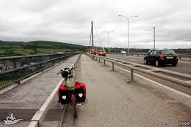
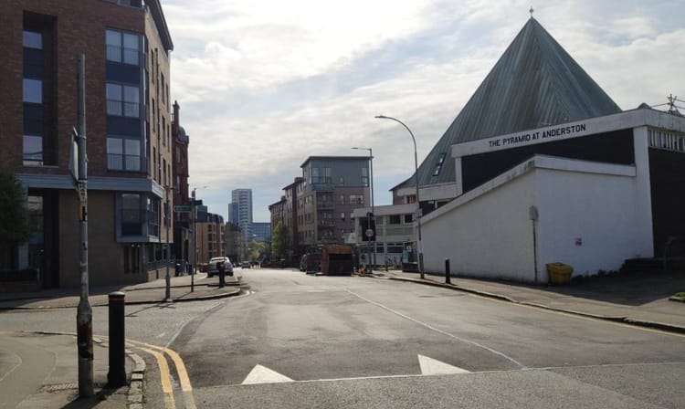
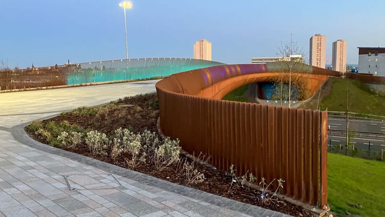
Details of this proposal for speed cushions along Sunnybank Street to slow traffic down near the new school (being built behind the hoarding on the photo above) were contained in Digest 36, Item 1.3. We wrote in to Glasgow City Council to ask about the status of the bus/taxi/cycle gate at the north end of Sunnybank Street on 13 June but no response had been received by 20 June when this letter of objection to the proposals was submitted. It’s a nonsense to have a new school, in what was an athletes’ village, with no cycle access for the school pupils, their parents and teachers.
Then, on 23 June, an email, dated 21 June, landed in the Consultations in-box and it is staggering! This “gate” has apparently been painted on the road for at least 5 years but is inoperative! Read on for the full text of the GCC response (operative clause put in bold by GoBike) and the GoBike request for clarity:
“MESSAGE SENT ON BEHALF OF MICHAEL BRADY, GROUP MANAGER – TRAFFIC AND ROAD SAFETY, NEIGHBOURHOODS AND SUSTAINABILITY
Dear Ms Fort
Thank you for your undernoted email regarding the proposed traffic calming for Sunnybank Street and your enquiry concerning the status of the bus gate at Springfield Road.
I can confirm that a Traffic Regulation Order was not promoted for the bus gate and as such it cannot be enforced. As part of the works for implementing the proposed traffic calming for Sunnybank Street, the existing bus gate signage and associated markings will be removed and replaced with new traffic calming ahead signage.
I trust the above information is of assistance, however, should you require any further information please contact (name and phone number removed by GoBike)
Michael Brady, Group Manager – Traffic and Road Safety, Neighbourhoods and Sustainability
(MAIL ID: 385597)“
“——– Forwarded Message ——–
| Subject: | Re: The Glasgow City Council (Sunnybank Street) Traffic Calming Scheme 20__STATUS OF BUS/TAXI/CYCLE SECTION |
| Date: | Thu, 13 Jun 2019 14:38:08 +0100 |
| From: | Tricia Fort <consultations@gobike.org> |
| To: | (removed by GoBike) |
| CC: | Mailroom, Land Services <LandServices.Mailroom@glasgow.gov.uk>, GoBike! Convenor <convenor@gobike.org>, Brown, Andrew (LES) <Andrew.Brown@glasgow.gov.uk> |
Xxxxxx, hello,
I phoned a few minutes ago and your colleague was good enough to answer your phone. I told him I would email – here it is.
We have received the information below and GoBike will be submitting a response, but before I do perhaps you can clarify the status of the bus/taxi/cycle only section of Sunnybank Street? This runs, as no doubt you are aware, between Springfield Road and Garvald Street, ie right outside the new school that is currently being built.
One of our members forwarded the screenshot, attached, of the entrance to Sunnybank Street to me and I went out there yesterday afternoon to have a look at the site. I took the attached photo of the south end of this bus/taxi/cycle only section, having followed a supermarket delivery van into this very same section! I was then quite astounded to see other vehicles drive through; at one point there were 4 vehicles, that were neither buses nor taxis, in that short section. Perhaps not surprisingly, one driver, who noticed that I was taking photos, doubled back to tell me that “This hasn’t been a bus lane since 2014”.
If that is the case, it seems strange that about 50% of the vehicles I saw in the 10 minutes or so that I was there, chose to turn left from the southern part of Sunnybank Street into Garvald Street.
Could you please confirm:
- Is the northern part of Sunnybank Street still restricted to buses, taxis and cycles?
- If yes, why do a significant number of vehicles ignore the very clear signage (even with the damage to the signage pole shown on the photo)?
- If yes, why have the drivers of these vehicles not been prosecuted?
- If yes, why is there no camera at the site?
- If no, why are the road markings and traffic signs still in place?
- If no, when was this declassification change made?
I would be grateful for a prompt response so that I may reply to the consultation before the closing date.
Thank you,
Tricia Fort
for Consultations, GoBike, Strathclyde Cycle Campaign, www.gobike.org“
Thus it took them over a week to reply, but how could anyone with “SAFETY” in their job title allow such a thing to happen, and for so long?
We wonder why there is so much speeding, so much driving into advance cycle boxes, yellow hatched junction boxes, cycle lanes etc etc. Does anyone care except for us?

3.2 Glasgow, Denmark Street, no waiting and loading: GoBike response

The proposal to ban loading and waiting at any time on Denmark Street in Possil was published in Digest 36, Item 1.2. We were told that indiscriminate and obstructive parking was blocking access for lorries to commercial premises and blocking footways, thus inconveniencing pedestrians.
Almost out of time, on the evening of the closing date, 18 June, this email was submitted as the GoBike response:
“Hello,
Many thanks for the opportunity to comment on the proposals below. GoBike is ambivalent about this proposal but we do have the following questions:
- Have the resources been identified to ensure that the restrictions are complied with? So often we respond to similar consultations and the standard response is that it is the responsibility of Police Scotland, or perhaps in this case, traffic/parking wardens to ensure compliance. Yet we are not aware of any increase in the budget of these bodies to ensure compliance and all around the city we see evidence of non-compliance with parking regulations, speed limits etc.
- Why hasn’t a more imaginative scheme been developed? This is an area of lower than average car ownership in a city with relatively low car ownership, yet we see no evidence that active travel is being encouraged. Denmark Street is wide, there are amenities along it such as a community centre, yet there is no safe cycle route. The construction of cycle lanes would reduce the space available for the storage of motor vehicles and encourage the local populace to improve their health by becoming more active. The City Council should exploit all available opportunities to improve active travel in this city, rather than having specific cycle schemes.
We look forward to better things.
Yours, for GoBike “
3.3 Glasgow, University Avenue, Traffic Regulation and Parking controls: holding response

You might remember that we submitted a very detailed objection to the proposals to remove part of the Colleges Cycle Route and just have painted cycle lanes on the uphill sections of University Avenue? Here’s a further copy.
We have now received, dated 20 June, this holding response:
“THE GLASGOW CITY COUNCIL, (UNIVERSITY AVENUE AND UNIVERSITY PLACE), (TRAFFIC REGULATION AND PARKING CONTROLS) ORDER 201_
I am writing to confirm receipt of your correspondence regarding the above named Traffic Regulation Order. Following the publication period, officers shall commence an analysis of all correspondence received and issue you with a considered response in due course.
Please note that timescales for preparing and distributing a considered response can be influenced by the quantity and nature of correspondence received.
Yours faithfully” etc
Let’s hope they come up with a satisfactory solution!
3.4 East Dunbartonshire: Traffic Regulation Orders – (i) Car Park Charging in Bishopbriggs & Bearsden; and (ii) Westerhill Rd, Bishopbriggs Waiting & Loading Restrictions.

EDC have informed us, 20 June, of 2 Traffic Regulation Orders that have now been approved:
Good morning

The  two  traffic  regulation Orders mentioned below have now been made and
will  become  effective  on Monday, 19 August 2019.  Attached are copies of
the  Orders  and  plans,  together  with  copies of the Notices that are to
appear  in  the editions of the Bishopbriggs Herald that is published on 26
August  and  Milngavie  &  Bearsden  Herald  that is published on 28 August
2019, as appropriate.

Kindest Regards,

Fiona Stirling
Legal Services
12 Strathkelvin Place
Kirkintilloch
G66 1TJ

Telephone 0141 578 8012 (direct dial)

(i) The East Dunbartonshire Council ( Bearsden and Bishopbriggs)
(Off-Street Parking Amendment) Order 2019
(See attached file: 190620 Car park Amendment charging Bearsden &
Bishopbriggs.pdf)

(ii) The East Dunbartonshire Council (Westerhill Road, Bishopbriggs) (No
Waiting and No Loading at any Time Restrictions) Order 2019

(See attached file: 190620 Westerhill Rd Waiting & Loading
Restrictions.pdf)
GoBike was not consulted on the car parking charges but did approve the changes to Westerhill Road, where footway/kerbside parking was potentially affecting people both walking and cycling. Details were in Digest24, Item 1.4 and our response was in Digest 26, Item 1.1.
3.5 Glasgow, Hyndland, Hughenden and Dowanhill West: implementation of 20mph

in Digest 27, Item 1.6 we included the details of Glasgow City Council’s proposals to make this area a 20mph zone and we also included our letter of support. We did, though, ask for the default policy of contraflow cycling to be enacted. This appears to be missing from this email, dated 18 June, confirming that 20mph will be introduced:
“MESSAGE SENT ON BEHALF OF ANDY WADDELL, DIRECTOR OF OPERATIONS, NEIGHBOURHOODS AND SUSTAINABILITY
Dear Sir/Madam
THE GLASGOW CITY COUNCIL (HYNDLAND, HUGHENDEN AND DOWANHILL WEST) (20mph SPEED LIMIT ZONE) ORDER 2019
I refer to your support of the above named Traffic Regulation Order and can advise that your support was reported and considered. The Council have decided under its scheme of delegated functions to proceed with the proposals as advertised. The Order was made on 7 June 2019 and an advert was be placed in the Evening Times on 13 June 2019 stating that the Traffic Regulation Order has been made. The earliest date the Order will come into force will be 22 July 2019.
Should you require any further information on the above named Order please contact my assistant (name and phone no removed by GoBike).
Yours sincerely”
etc
So there we have it; one-way streets were introduced to allow car storage, but also allowed cars to be driven faster (with no opposing traffic) and now a 20mph speed limit that probably won’t be enforced is being brought in. Ah well.
So that’s it for this fortnight. The school holidays are almost upon us and response times have been extended to accommodate staff breaks, but your Digest will be back in 2 weeks, with another interesting bundle of news.
