Consultation Digest (Local) Issue 77, 5 January 2021
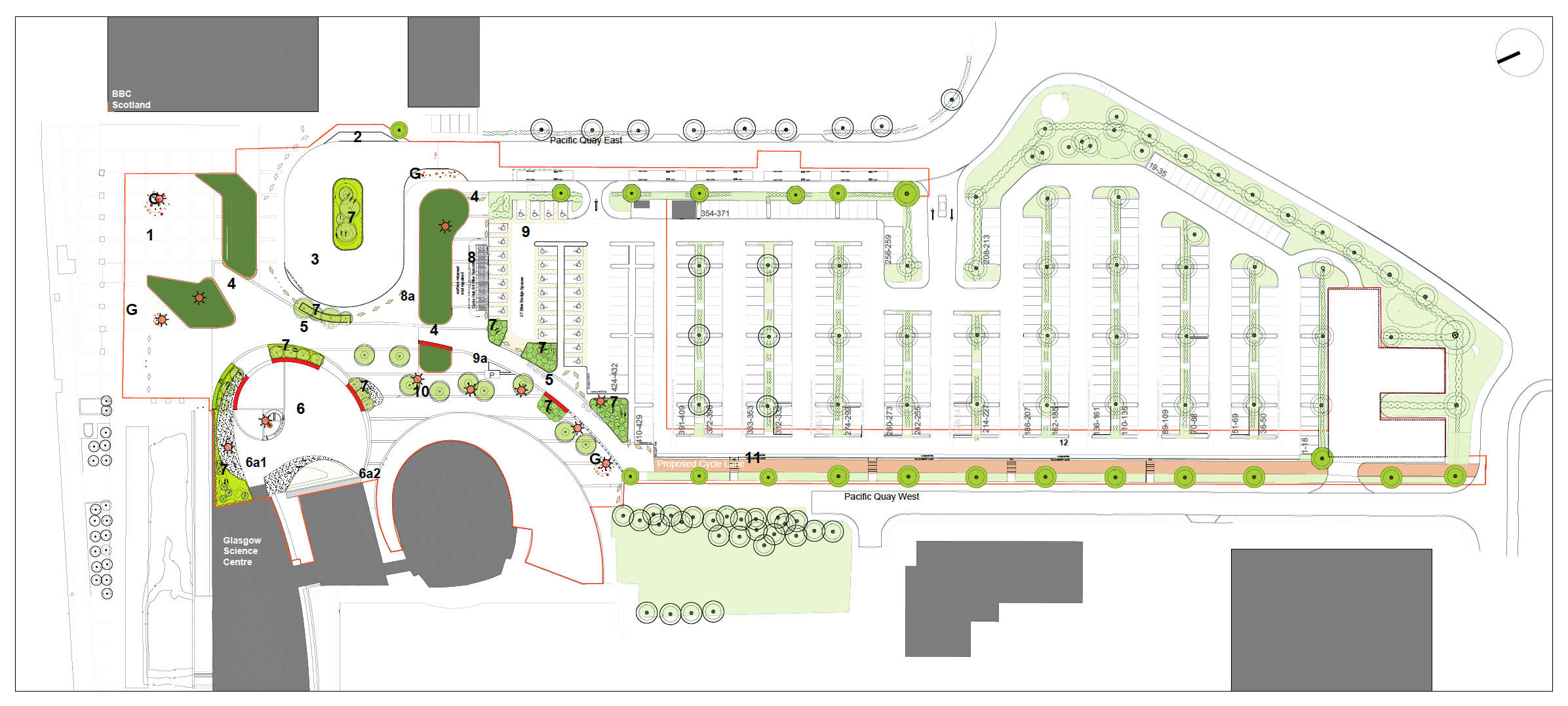
Happy New Year for 2021. Some long term consultations and a planning application for Pacific Quay.
Not many new consultations to start the year. However, it's a last chance to comment on some existing consultations and a planning application at the Science Centre/BBC has some feedback.
The weather hasn't helped but have you been able to try any of Andy's three infrastructure routes around Glasgow?
There’s still time to sign the petition for segregated cycle lanes at the Kelvin Way-University Avenue junction (until 28 January). It's near Hillhead Primary School, with its School Street…
This Digest includes links in the Contents page so you can jump straight to a topic if you want to.
Contents
(new consultations in bold)
Section 1: Current Consultations
- Glasgow City Council – School Streets, Glasgow (Prohibition of Motor Vehicles) Order 202_, (closes 11 January 2021)
- East Dunbartonshire Council – Proposed Local Development Plan 2 (LDP2), closes 15 January 2021
- Glasgow City Council – North Glasgow Strategic Development Framework (SDF), closes 29 January 2021
- Glasgow City Council – Protected Junction Trial consultation (Victoria Rd)
Section 2: Forthcoming Consultations
None.
Section 3: Consultation Feedback
Section 1: Current Consultations
(in date order for responses)
1.1: Glasgow City Council – School Streets, Glasgow (Prohibition of Motor Vehicles) Order 202_, (closes 11 January 2021)
As covered in Digest 75, Item 1.4 this order makes trials into permanent School Streets at six primary schools: Bankhead PS, Broomhill PS, Hillhead PS, Lourdes PS, Our Lady of the Rosary PS and St Blanes PS. GoBike backs this move and hopes members can show support too.
1.2: East Dunbartonshire Council – Proposed Local Development Plan 2 (LDP2)
(closes 15 January 2021)
The deadline is approaching for East Dunbartonshire Council's proposed LDP2 (as seen in Digest 72, Item 1.8). If you want to comment on how EDC could include active travel in future developments, you'll need to email them soon. Their track record includes the first phase of the Bearsway and not very much since. Certainly no Spaces for People projects as they were the only mainland council not to bid for funding. See www.eastdunbarton.gov.uk/LDP2 and email: development.plan@eastdunbarton.gov.uk.
1.3: Glasgow City Council – North Glasgow Strategic Development Framework (SDF),
(closes 29 January 2021)
This featured in Digest 74, Item 1.5 with the GoBike response written by Brenda. It covers a large area north of the M8 to Possil and from Maryhill Rd to Springburn. It's about to lose some of the canal path during the Stockingfield bridge works. Recent gains include St Rollox Dr (past Sighthill Cemetery) and the Spaces for People lanes (on Bilsland Drive and Hawthorn St). See the North Glasgow SDF consultation document (PDF) and the online survey. The deadline was extended to 29 January 2021.
1.4: Glasgow City Council – Protected Junction Trial consultation (Victoria Rd)
GCC have a consultation open about the new protected junctions on the South City Way (as seen in Digest 74, Item 1.6). These are a trial for two years and the consultation doesn't have a deadline. So, you should be able to submit comments about the new junctions at any time. They're a first in Glasgow that GoBike would like to see repeated elsewhere.
Section 2: Forthcoming Consultations
None forthcoming this time.
Section 3: Consultation Feedback
3.1: Glasgow Science Centre – Public realm improvement works/alterations to road layout and car park (Planning Application 20/02068/FUL)
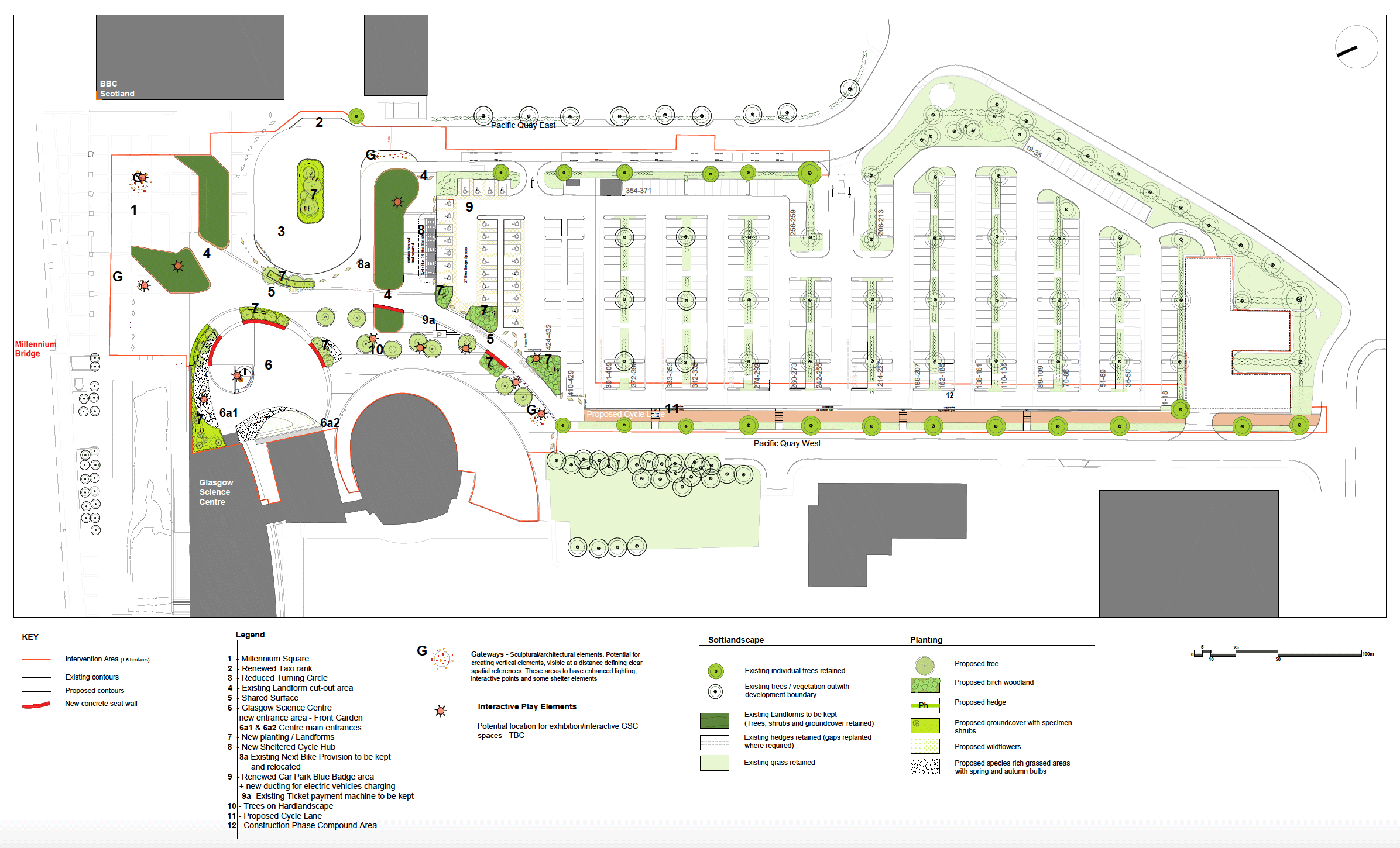
This planning application first featured in Digest 69, Item 1.5. The plans make some changes to the public space between the Science Centre and BBC building. Just now, you have to dodge concrete barriers between the Millennium Bridge and Pacific Quay service road. A direct path between them would help, since it can be a busy area.
However, this plan is for planting and seating outside the Science Centre with a new cycle path next to the road (in pink, above). This will run along the edge of the car park (replacing about 50 parking spaces) and across a side entrance road. It continues on what is currently a narrow grass strip, then goes across the pavement at a corner. It's not clear if the pavement is shared use or if the cycle path joins the road.
The northern end of the cycle path leads to a curved shared space (marked 5), which people will walk across to get to the car park. This path will be built on what is currently a road within the car park. The turning circle between the Science Centre and BBC building will also be reduced. There is a 'sheltered cycle hub' with 94 bike parking spaces (marked at point 8). This seems to replace the small existing bike shelter for staff/visitors (maybe with double-deck bike parking). However, the existing Nextbike hire station is not shown at all. Update: seems Nextbike station is being retained (but isn’t marked on plan).
The plans do convert car parking spaces and some road space and into space for people walking and cycling. Overall, the scheme looks like it's been planned for people visiting the Science Centre rather than people who cycle to work or for transport. The same company, Austin-Smith:Lord, are running the consultations about city centre districts.
See the documents on Glasgow City Council's planning portal, including a GoBike response objecting to the route being less direct. These don't seem to have been taken on board as the council has approved the plan, subject to conditions (GCC don't give any further details).
Looking forward…
Further into 2021, new Spaces for People routes are due in Renfrewshire, East Renfrewshire and South Lanarkshire. Also, new cycle/pedestrian bridges are being built to Sighthill in Glasgow and Inchinnan, Renfrewshire. Perhaps we'll have more next time.
