Consultation Digest (Local) Issue 91, 20 July 2021
Consultations around the edge of Glasgow (and city centre parking).
There's plenty in this Digest despite it being holiday time, with weather to match for a change (in Glasgow Fair!).
This issue is mostly about the fringes – both inside and outside the city boundary; in more and less deprived areas. It's also about city centre parking and emissions, which is often linked to people driving in from areas around the edge of Glasgow.
The Infrastructure Update has a bit more from north and east but also a project from the West End, just in case anyone's getting withdrawal symptoms…
Infrastructure Update
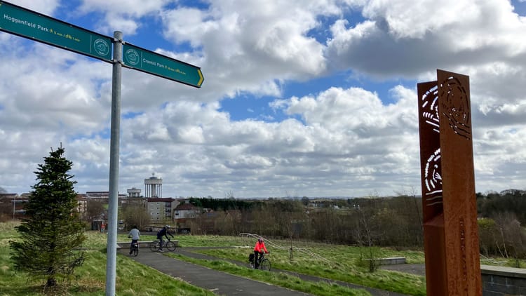
- A thread about recent route developments in Glasgow, looking great in sunshine.
- Beith St has new access and drop kerbs added.
- London Rd has had soft segregation removed at Celtic Park (but chalk added).
- At the other end of London Rd, photos of Mount Vernon junction. It's good this phase of the East City Way is complete but there are issues going eastbound, as GoBike warned previously.
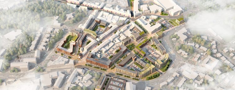
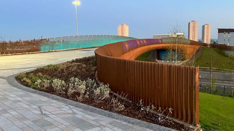
- A bird's eye view of the new Sighthill and a few close-ups of its new, but rusty, pedestrian/cycle bridge before it's installed.
Contents
(new consultations in bold – link jumps to article)
Section 1: Current Consultations
- Glasgow City Council – City Centre Traffic Management Order 2010: Variation No.29, GHA Parking Areas (ends 3 Aug)
- St. Paul's Youth Forum – Flourishing Molendinar second consultation (ends 6 Aug)
- Glasgow City Council – Garnethill Traffic Management and Parking Controls Order (ends 13 Aug)
- East Dunbartonshire Council – Bishopbriggs Town Centre Regeneration (ends 15 Aug)
- East Renfrewshire Council – Ayr Road (A77): Spaces for People, Phase 2
- Glasgow City Council – Low Emission Zone consultation (ends 2 Sep)
- Glasgow City Council – Inner East Strategic Development Framework (ends 3 Sep)
- East Dunbartonshire Council – Active Travel Discussion (ends 28 Sep)
Section 2: Forthcoming Consultations
None this time.
Section 3: Consultation Feedback
- Mount Florida Community Council – Letherby Triangle planning decision
- St. Paul's Youth Forum – Flourishing Molendinar first consultation feedback
Section 1: Current Consultations
(in date order for responses)
1.1: Glasgow City Council – City Centre Traffic Management Order 2010: Variation No.29, GHA Parking Areas
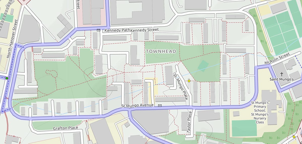
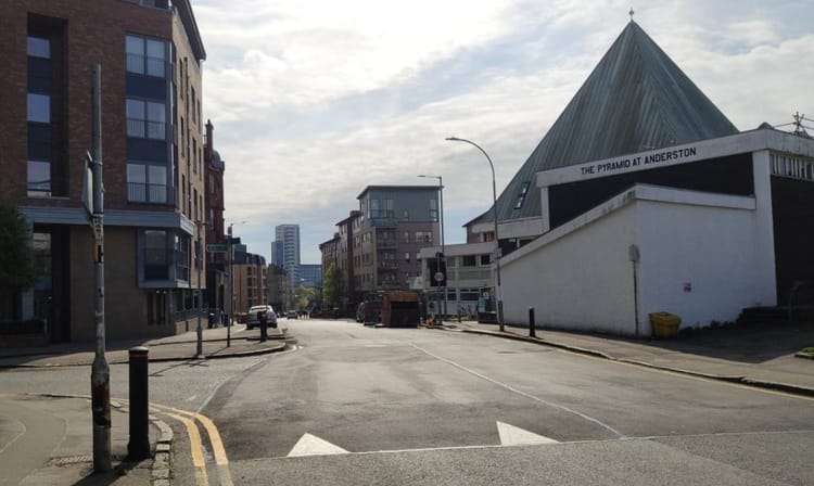
'GHA Parking Areas' refers to land in Townhead owned by Glasgow Housing Association. The area is east of Buchanan Bus Station and Glasgow Caledonian University, behind the high flats. Resident's parking spaces around Kennedy St and St Mungo Avenue have been used as free parking by shoppers/commuters. This order introduces parking restrictions which can be enforced.
There are the usual documents for a TRO: plan of GHA parking areas, GHA areas draft report, GHA areas press notice and the usual statement of reasons. Respond by e-mail to lestraffic@glasgow.gov.uk by 3 August 2021.
1.2: St. Paul's Youth Forum – Flourishing Molendinar second consultation
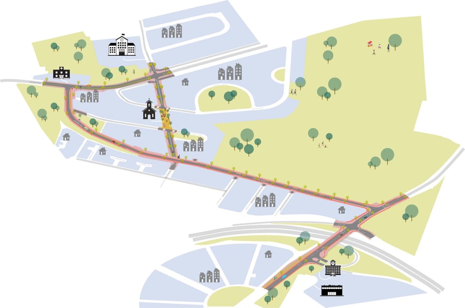
The last mention of the Flourishing Molendinar project was in Digest 82, Item 1.8 (when it changed to its current name). The main image on this Digest shows the area covered by the project in the north east of Glasgow.
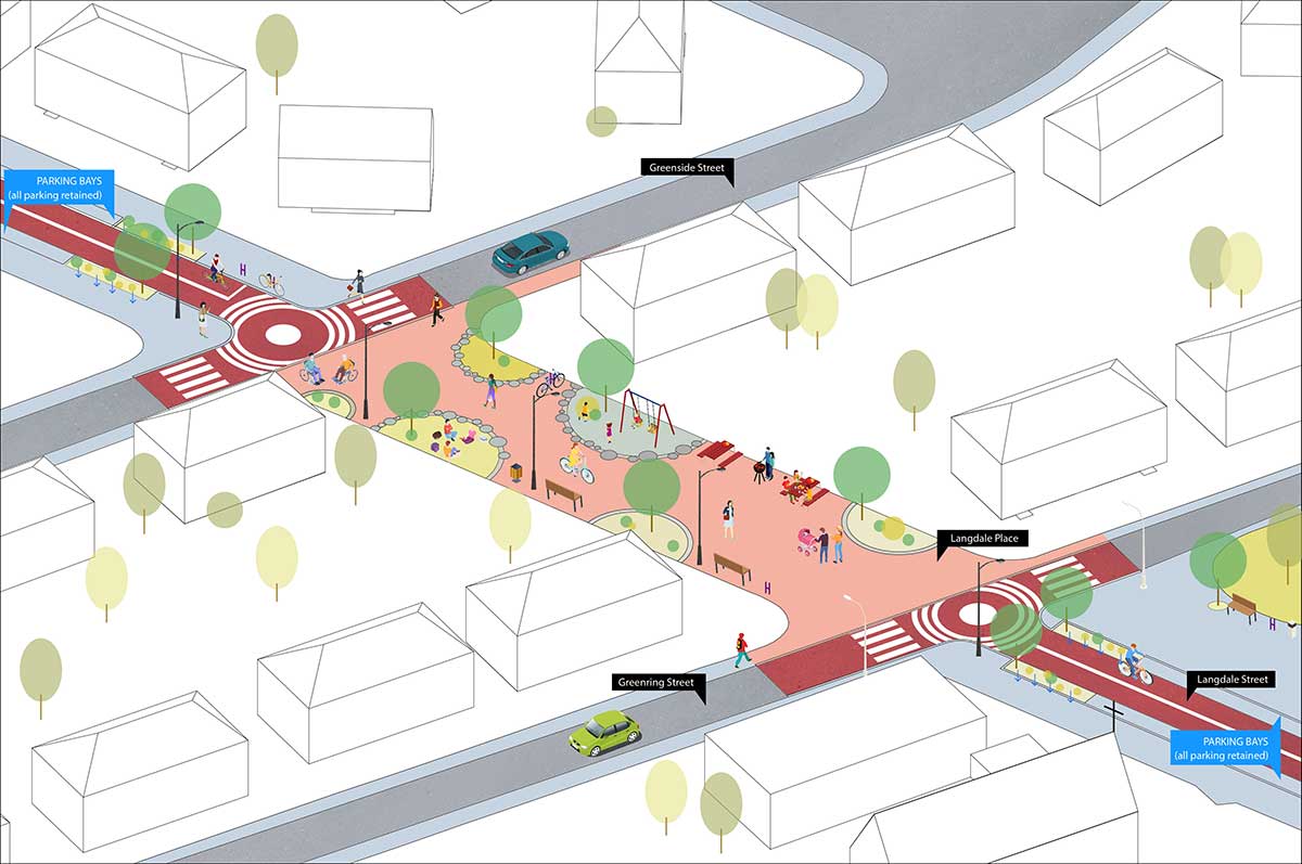
The next stage of the Flourishing Molendinar project has produced some eye-catching plans. In particular, the pedestrianised area proposed for Langdale St, which could be an example for other so-called 'liveable' neighbourhoods.
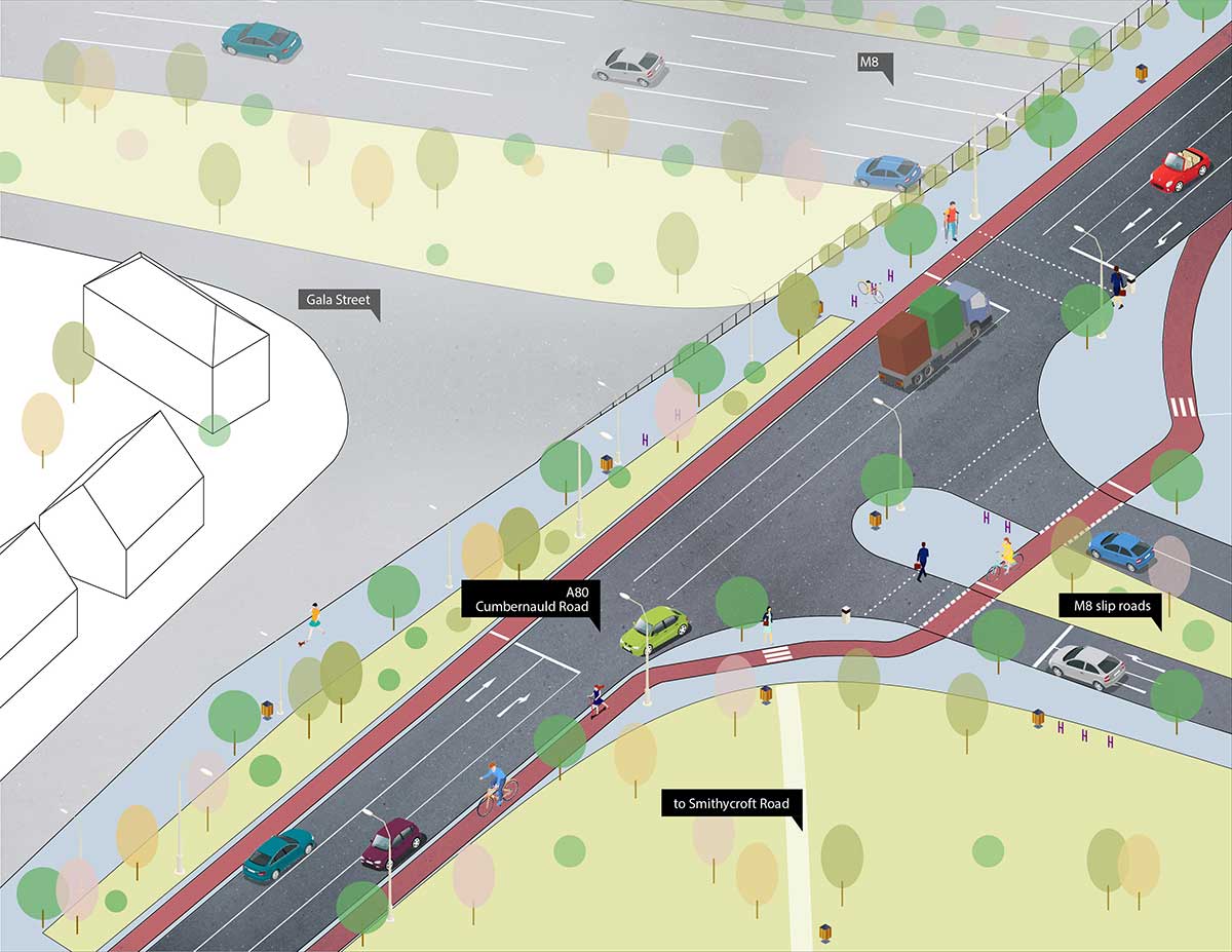
However, there was also big news for anyone who cycles on Cumbernauld Rd (A80) across the M8 motorway. The bridge is a four/five lane dual carriageway, which many pupils have to cross to get to Smithycroft Secondary School. FloMo's plan would reduce the (wide) lanes and add segregated cycleways. If it goes ahead, this would transform that stretch of road into a far more people-friendly place.
For more on the above (and Royston Rd) go to the FloMo survey (ends 6 August). We look forward to seeing what comes out of it.
For more about the phase 1 consultation, see Item 3.2.
1.3: Glasgow City Council – Garnethill Traffic Management and Parking Controls Order
Garnethill, north of Sauchiehall St, is known for (what's left of) Glasgow School of Art. It's also home to a few schools, places of worship, hotels and several thousand residents. The area has steep, tight streets and existing one-ways, as well as the usual parking issues.
GoBike posted about the consultation events for Garnethill back in March 2018. The plans involve a lot of yellow lines, parking restrictions on back lanes and the creation of car parking bays. One thing that isn't included in the plan is the two-way section of Hill St, at St Aloysius College, created by TTRO in April (Digest 85, 3.1). However, the parking bays are still included, which reduce the road to one car width.
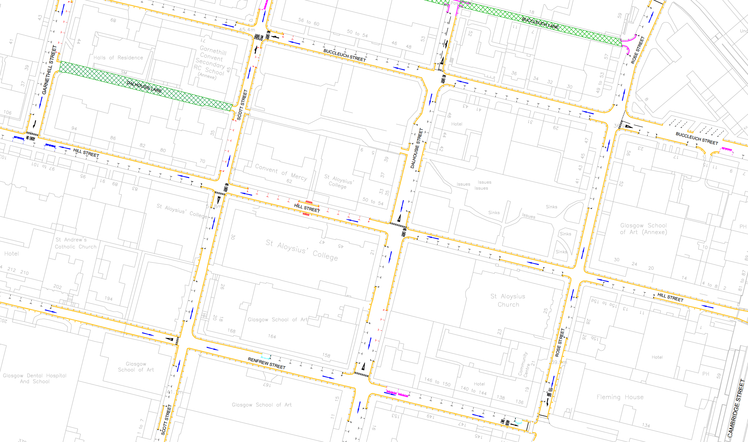
Any neighbourhood plan is of most interest to people who live in the area. However, issues in Garnethill could have a knock-on effect on Sauchiehall St and Cambridge St so it's in our wider interest that it works.
Again, there are the usual TRO documents: Garnethill plan, Garnethill draft report, Garnethill press notice and the standard Statement of Reasons. Respond by email: garnethillparking@glasgow.gov.uk by 13 August 2021.
1.4: East Dunbartonshire Council – Bishopbriggs Town Centre Regeneration
This consultation covers Bishopbriggs town centre and two City Deal projects – phase 5 of Bishopbriggs Relief Road (BRR5) and the A803 corridor (Springburn Rd/Kirkintilloch Rd).
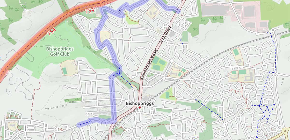
Bishopbriggs town centre is marooned between NCN754 (Forth & Clyde canal) and the 'Wester Way' shared path, without good active travel links to either. The Wester Way was built alongside the BRR on Westerhill Rd, where BRR phase 4 caused years of disruption. Both road and path peter out opposite the Aviva offices, north of the rail line to Lenzie. BRR5 doesn't have a route decided yet but could affect some paths in the area.
The striking thing about the town centre 'Future' images is how little the infrastructure changes apart from slightly wider footways and planting more trees. There are a few cyclists in the images but no segregated cycle lanes. The town centre work is part of a City Deal project worth nearly £35m, so they're not skint.
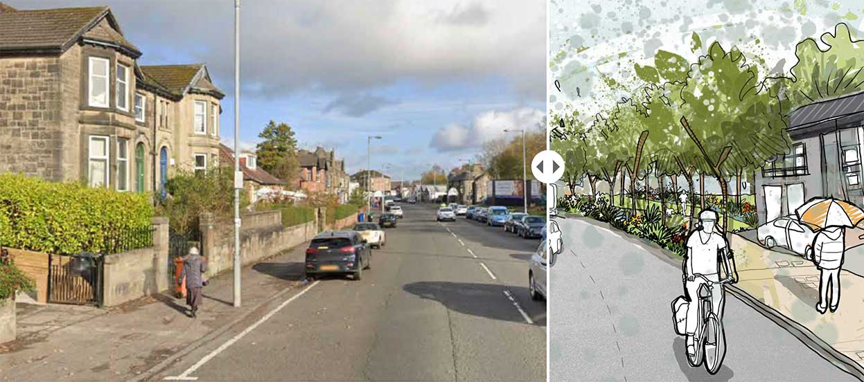
If you've ridden any routes in the area, it's worth putting a word in for cycling. See the Bishopbriggs consultation webpage and Bishopbriggs Public Realm Plan survey. Consultation closes 15 August.
1.5: East Renfrewshire Council – Ayr Road (A77): Spaces for People, Phase 2
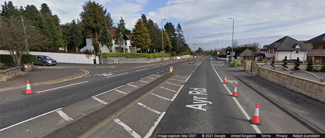
The Ayr Rd section of the A77 route at Newton Mearns is south of the Fenwick Rd Spaces for People lanes, which we covered back in January 2021 (Digest 78, 1.4). GoBike staged a local Pedal on Parliament event about parking on Ayr Rd's bike lanes back in 2019.
The phase 2 consultation is partly about replacing the phase 1 cones with light segregation. However, it also removes the segregation in some sections (like at Mearns Cross). It includes adding parking bays with the bike lane outside it in one location but trialing a parking-protected bike lane at Ashtree Grove (as in image, below).
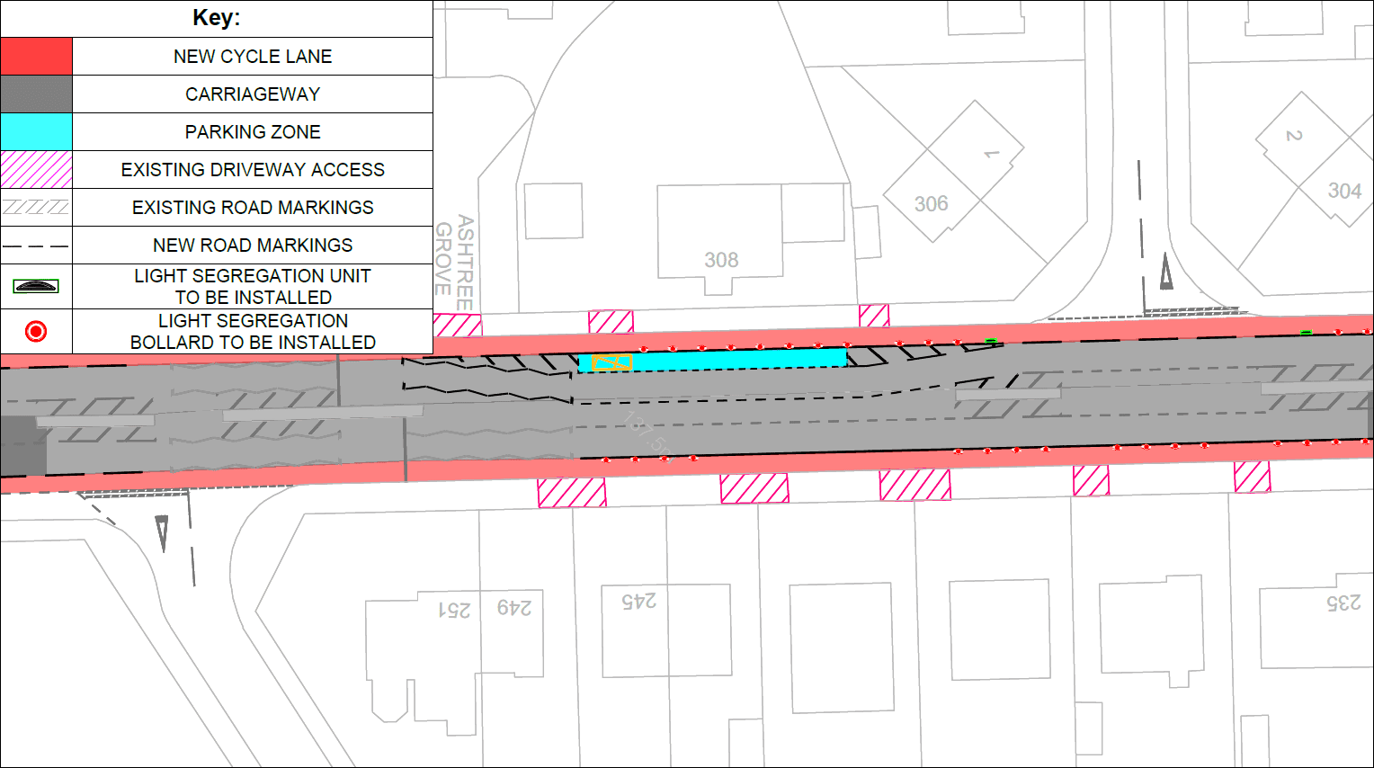
The mixed approach probably reflects that on-road, segregated cycleways are still very new in East Renfrewshire (or anywhere outside a city). Issues in other towns, like the Bearsway extension being scrapped and the removal of lanes on Holmston Rd, cast a long shadow. Newton Mearns is just as affluent and around 90% of people in East Ren have access to a car. However, it has younger demographics than either Milngavie or Ayr.
East Ren differ from Glasgow by only asking how to improve the scheme, not whether people want rid of it. If ERC wait to get feedback before making changes then that would be an improvement on London Rd too. A few comments in the Commonplace survey allude to Glasgow ripping out segregation so that seems to have had an effect beyond the city boundary.
Light segregation options include 'flexible delineator posts' or 'wand orca' units. For examples, maps and more details, see the Ayr Road Phase 2 consultation page. No obvious deadline on this one.
1.6: Glasgow City Council – Low Emission Zone consultation
Glasgow's city centre Low Emission Zone (LEZ) has only applied to some buses so far. GCC are consulting before it changes to include cars and other motor vehicles. It covers most of the city centre – north of the river, conveniently inside the M8 and eastwards to High St/Saltmarket.
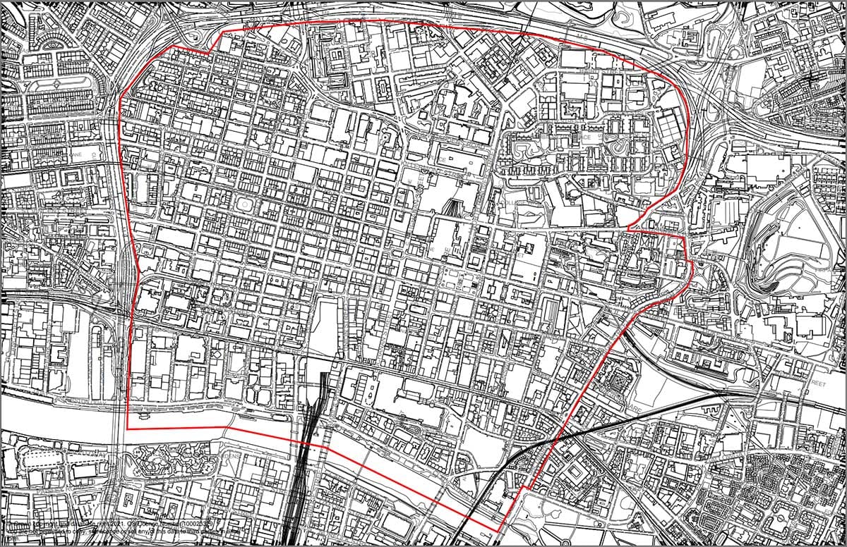
However, the LEZ won't include cars any time soon as there are some 'grace periods' built into the plan at the moment. One year until it comes in, so summer 2022. Then another year until it becomes enforceable – 1 June 2023. There will be a further year's grace for folk who live in the city centre (until 1 June 2024). Some exemptions apply to people with disabilities, emergency vehicles, etc.
One good thing about the short survey is it does ask you about the above. So, if you think the LEZ area is too small or the grace periods are too long, you can tick those boxes and add a comment too.
See the Glasgow LEZ consultation page and LEZ online survey. Closes on 2 September 2021.
1.7: Glasgow City Council – Inner East Strategic Development Framework
The ‘Inner East’ goes from High St out to Carntyne and Tollcross, between the River Clyde and the M8 (just short of FloMo's patch). Like previous SDFs for other areas, it has themes about connections and sustainability but is mostly about identifying development opportunities. Some planned cycle routes and the Avenues Plus active travel scheme are included on a map with 'missing links'. There are some issues with the map, like the red line between Barrowfield and Parkhead, counting the bus lane on one side as "off road/segregated". Although it's patchy, it puts more focus on active travel than previous strategies about the East End.
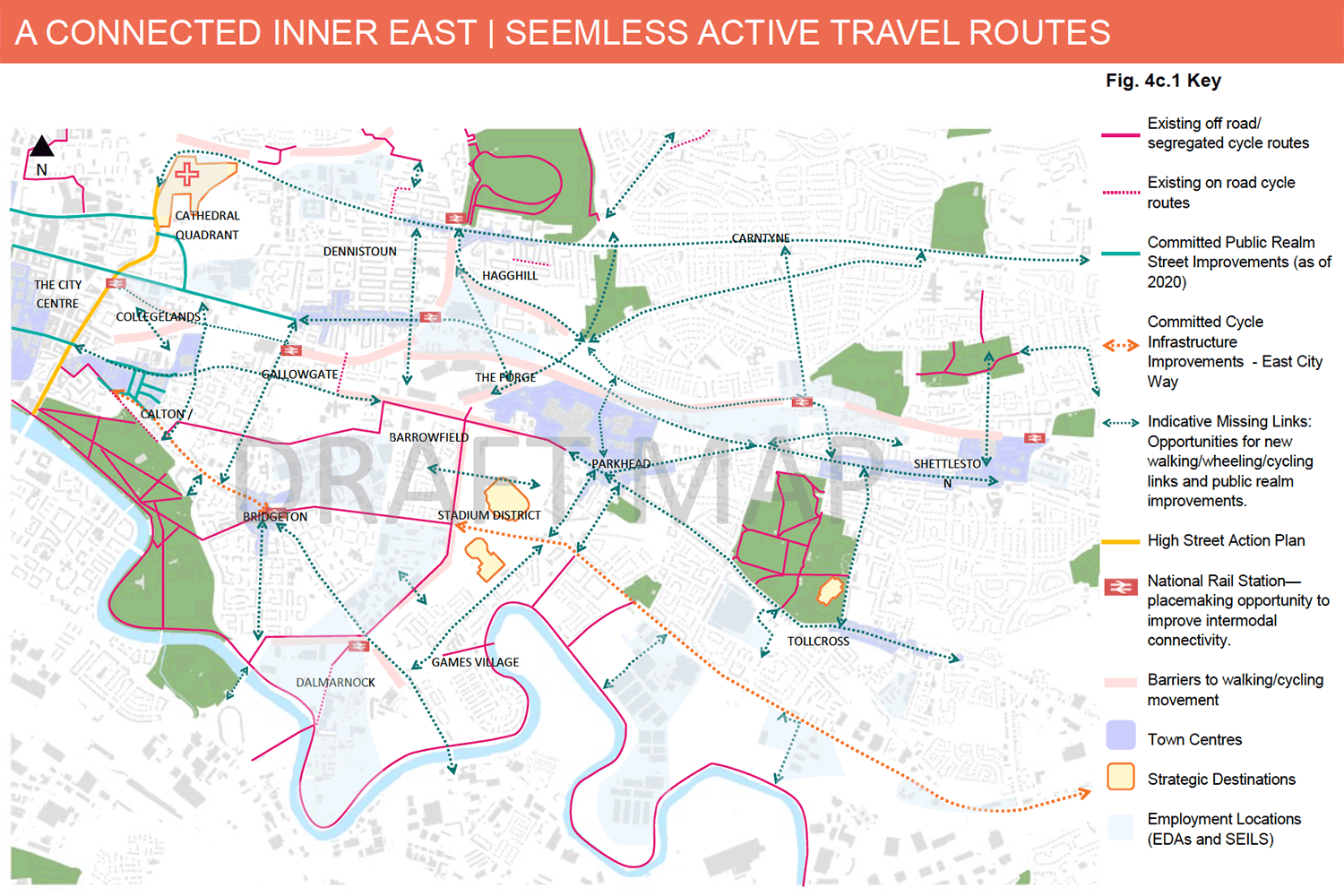
A few of the rail improvements in the document have been talked about for over ten years, such as the Parkhead rail halt. However, it's the East End Regeneration Route (EERR phase 3) that seems to be back on the agenda due to new funding. It's a dual carriageway that would run through Hogarth Park and under Edinburgh Rd and Cumbernauld Rd to the M8.
See the Inner East consultation page for link to the PDF document and SDF survey. Ends 3 September 2021.
1.8: East Dunbartonshire Council – Active Travel Discussion
This was first in Digest 86, Item 1.2, with its ‘Ideas Map‘ for the area. Recently, East Dunbartonshire Council has brought in new parking restrictions on Milngavie Rd, opposite the remodeled junction to Allanton Sports Centre. It's small but possibly the first parking restriction since the Bearsway was built?
The Bearsway was due to extend to Kessington on the way to Glasgow. While researching this Digest, it emerged it has one of the oldest populations in Scotland. 52% of people of Kessington West are over 65 years old (page 19). Will the Bearsway ever get there?
There are no more consultation events until August/September. See a full list of events and background info on the Active Travel Discussion webpage. Closing date – 28 September 2021.
Section 2: Forthcoming Consultations
None this time.
Section 3: Consultation Feedback
3.1: Mount Florida Community Council – Letherby Triangle planning decision
This project was first in Digest 66, 1.3 when Mount Florida Community Council (MoFloCoCo) were consulting about it. It's good to see it progressing towards being built.
The plan is to close the end of Carmunnock Road at Cathcart Rd to link a triangular traffic island to nearby shops. It will have a viewing platform added and be used for leisure and cultural events. There's a handy overview of the proposal on the ReGlasgow website.
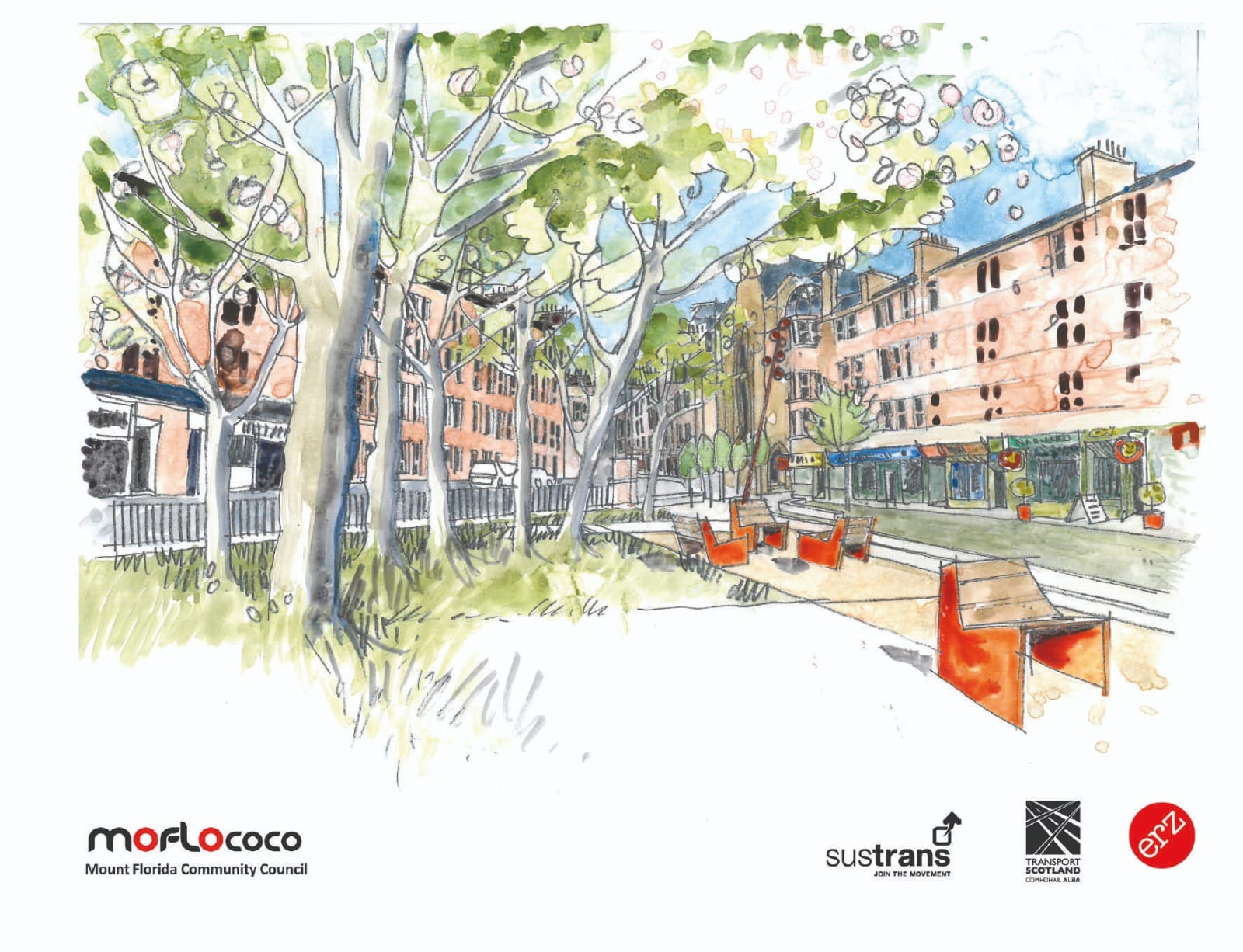
It's planning application 20/03067/FUL if you want to look at it on GCC's planning portal. Good luck to MoFloCoCo and their partners for the next stage.
3.2: St. Paul's Youth Forum – Flourishing Molendinar first consultation feedback
In addition to the new plans in Item 1.2, above, Flourishing Molendinar published data from their earlier consultation (Jan–May 2021). There are plenty of interesting results on the website homepage and in their Summary Report (PDF).
In particular, the data shows strong support for keeping Spaces for People measures, as long as they can be adjusted/improved. Overall, 89% wanted to keep the SfP measures in some form while only 11% wanted them removed (out of 152 responses). While FloMo is focussed on one local area, it's hopefully a good sign for the results of Glasgow City Council's wider SfP consultation (whenever those are published).

