Consultation Digest (Local) Issue 89, 22 June 2021
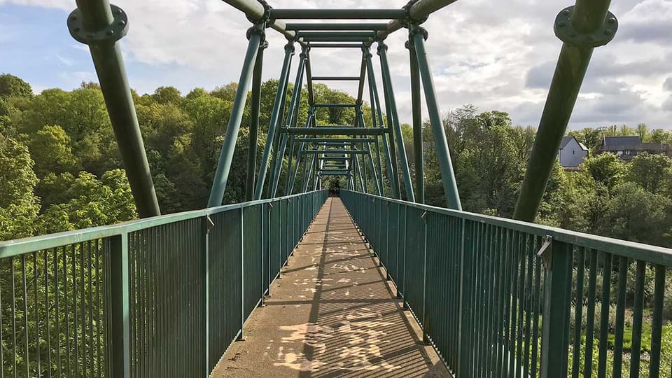
As the Euros continue there's a rare call-up for SPT to the Digest.
Glasgow's Spaces for People consultation has ended but East Ren's marches on. Near their border there's a new 20mph zone. A new road and active travel networks in Lanarkshire, 'Discussion' continues in East Dunbartonshire and more post-match analysis from Dennistoun.
Infrastructure Update
- It's good to see more Bikehangars going in across Glasgow but many are in inconvenient places, like blocking a filter in the Southside or near an entrance to Queen's Park. Some have been placed on the road but even then can be installed in front of drop kerbs, etc.
- Garscube Rd landscaping is in place as well as more bike warning lights at side roads.
- Further north, near Firhill St, the new Garscube Link to the canal is taking shape.
- Royston Rd pop-up lane seems to be finished but some locals aren't happy with the lane widths and new road layout at Broomfield Rd junction.
Contents
(new consultations in bold – link jumps to article)
Section 1: Current Consultations
- Glasgow City Council – Burnfield Road (20mph Speed Limit) Order (9 July)
- East Renfrewshire Council – Davieland Road Spaces for People project
- North Lanarkshire Council – East Airdrie Link Road, Stage 2 survey
- East Dunbartonshire Council – Active Travel Discussion (ends 28 Sept)
Section 2: Forthcoming Consultations
None this time.
Section 3: Consultation Feedback
- East Dunbartonshire Council – Canniesburn Toll, GoBike response
- Strathclyde Partnership for Transport – Regional Transport Strategy
- South Lanarkshire Council – Active Travel networks
- Dennistoun Community Council – Further update on Spaces for People scheme
Section 1: Current Consultations
(in date order for responses)
1.1: Glasgow City Council – Burnfield Road (20mph Speed Limit) Order
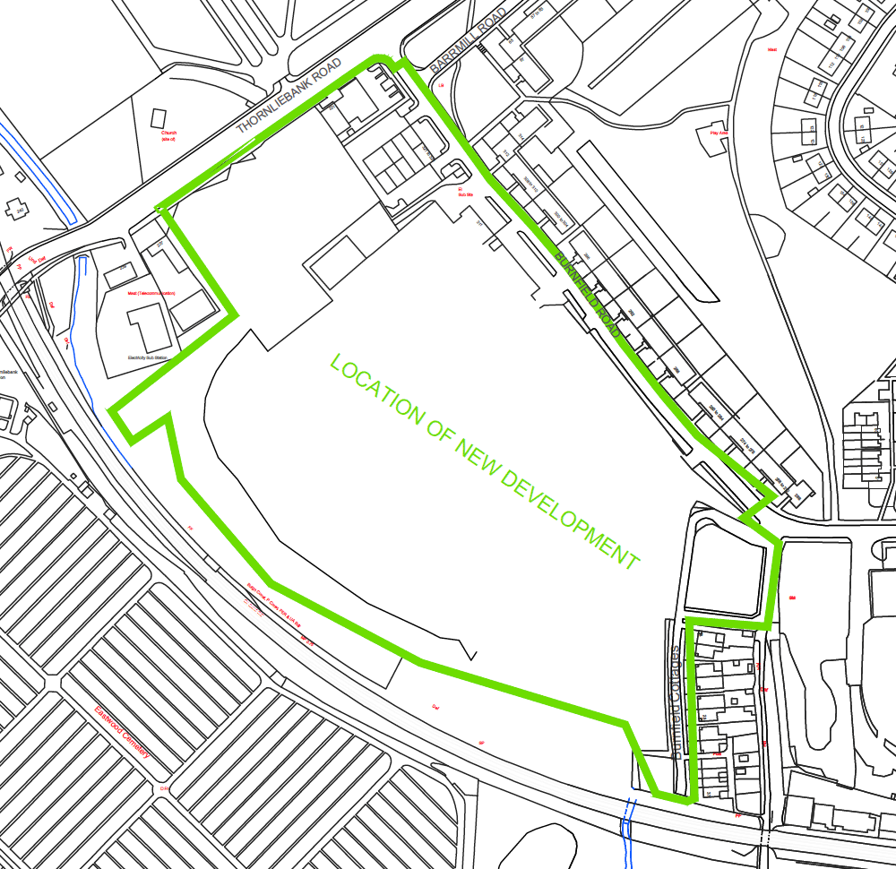
The order covers a former brownfield site near the Glasgow boundary with East Renfrewshire. It's off Thornliebank Road near the train station and Eastwood cemeteries. See the Burnfield Road area plan and site boundary PDFs for exact location.
The report for the Burnfield Rd order says it's applying recent policies to set a 20mph limit for a new development (Storey Grove – apparently before it's completed). Other documents include a press notice and the usual statement of reasons.
Deadline for feedback – 9 July 2021.
1.2: East Renfrewshire Council – Davieland Road Spaces for People project
First discussed in Digest 87, Item 1.4, Davieland Rd is next to Rouken Glen Park in Giffnock. This Spaces for People project includes a temporary bike lane in one direction, bollards to protect a footway and a bike phase at traffic lights. A few GoBike members have been to try it out and reported a few issues with triggering the bike phase at the lights.
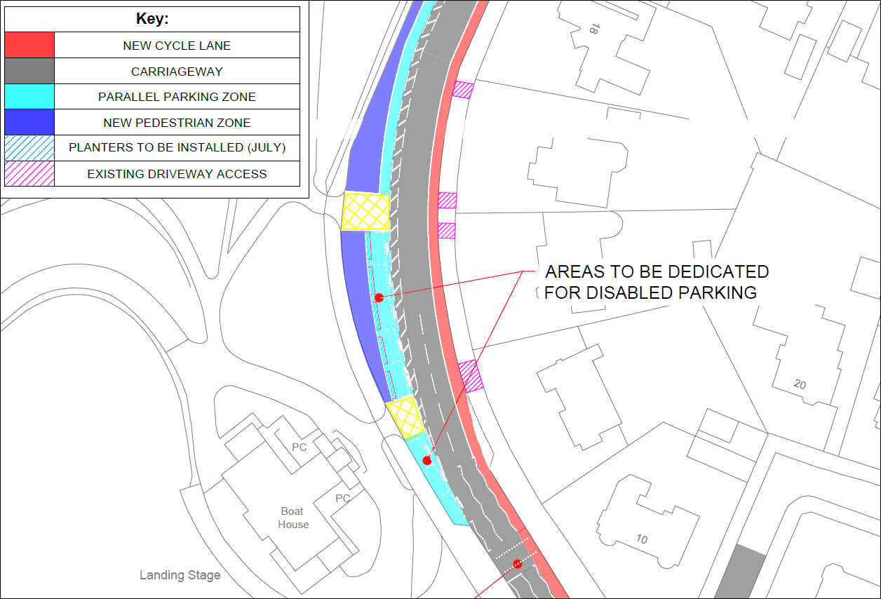
You can leave feedback about the scheme on the ERC’s Davieland Rd survey (no closing date is mentioned).
1.3: North Lanarkshire Council – East Airdrie Link Road, Stage 2 survey
This is a trunk road project that will bypass Chapelhall and Airdrie, as seen in Digest 88, Item 1.6. Active travel links were promised but details are scarce so far, apart from that they may be "separate" (possibly though Airdrie).
The road will link to the new Monklands hospital site at Wester Moffat, near Drumgelloch train station. In Digest 72, Item 3.1 we published the GoBike response about the hospital consultation, mentioning the on-road section of NCN75 nearby. Word has reached us that paths to improve the area have been discussed. Nothing official to report yet but fingers crossed for the future.
Meanwhile, see the East Airdrie Link Road, Stage 2 survey to give feedback about its route.
1.4: East Dunbartonshire Council – Active Travel Discussion
This was in Digest 86, Item 1.2, including its ‘Ideas Map‘ for the East Dunbartonshire area. While East Dunbartonshire Council haven't completed the Bears Way or done any Spaces for People schemes, Items 3.1 and 3.2, below, show they have done other active travel projects. However, these are still quite a long way from forming a comprehensive network and linking with neighbouring areas like Glasgow or North Lanarkshire.
There are no consultation events just now – the next online ones were due in August/September. See a full list of events and background info on the Active Travel Discussion webpage. Closing date – 28 September 2021.
Section 2: Forthcoming Consultations
None this time.
Section 3: Consultation Feedback
3.1 East Dunbartonshire Council – Canniesburn Toll, GoBike response
First covered in Digest 86, Item 1.3, there were two design options – one on-road and one on the footway. Both had serious drawbacks and sparked discussion about how the roundabout could be improved. That informed the GoBike response about Canniesburn Toll, which has now been sent to East Dumbartonshire Council. We'll report back if there's any response from EDC.
3.2: Strathclyde Partnership for Transport – Regional Transport Strategy

Strathclyde Partnership for Transport (SPT) is a regional transport partnership, which runs the Glasgow Subway and some specialist bus services. We don't often feature SPT, as they're not usually the main funders putting forward infrastructure proposals. However, one of their Regional Transport Strategy documents lists the active travel projects funded by SPT across the former Strathclyde region (tucked away at Section 5, Table 2a, item 5). To save you scrolling, here is the summary…
"Actions and Projects:
Support delivery of improved active travel infrastructure and networks across Strathclyde including supporting actions within local authority cycling & active travel strategies.
Update and Status:
A number of cycling projects have been completed or progressed by local authorities in the region with support from SPT since 2018/19, including:
- Argyll and Bute: Helensburgh - Dumbarton regional cycle route: completion of design phase for the remaining 6 sections, land purchase of 2 sections and construction of 1 section.
- East Ayrshire: Completion of the detailed design for Kilmarnock - Crosshouse Hospital cycle route.
- East Dunbartonshire: Completion of: Lenzie Station Sustainable Transport Hub; Twechar path improvements; local links to Meadowburn Primary School, Bishopbriggs; links to the John Muir Way/NCN755 and between Forth and Clyde Canal and Kirkintilloch Town Centre; Milngavie - Mugdock path improvements; and progress Lennoxtown Access Improvements including improved local network links to NCN 755.
- East Renfrewshire: Completion of 1km shared use path in Barrhead.
- Glasgow: Delivery of improvements to signage, wayfinding and monitoring equipment on city-wide network.
- Inverclyde: Completion of design phase for Cloch Road and Newark – Parklea cycle routes and delivery of wayfinding and safety improvements on local and national cycling networks. Contributed to the design of a new Toucan Crossing on the A8 Dalrymple Street which will improve access for pedestrians and cyclist between Greenock Town Centre and NCN75.
- North Ayrshire: Completion of widened footway on Kilwinning Road from Kilwinning Bypass to town centre and completion of path network upgrades between Irvine town centre and i3 Enterprise Area including a section of NCN.
- North Lanarkshire: Completion of upgraded link from Holytown Station to the A723 along Loanhead Road. Completion of Ravenscraig Cycle Path (construction) and completion of design phase for Croy station access improvements.
- Renfrewshire: Completion of design phase for Paisley to Renfrew Cycle Route.
- South Lanarkshire: Continued delivery of East Kilbride active travel network; completion of Bothwell-Uddingston NCN74 & NCN75 connection via Fallside Road and Bellshill Road. Completion of initial designs for further sections of Hamilton, Lanark and Carluke active travel networks.
- South Ayrshire: Completion of Phase 1 of the Loans to Troon cycle path project Harling Drive to Dundonald Road and partial construction of phase 2 through Marr. Completion of design phase and partial construction of 2.8km Dundonald - Barassie path.
In 2021/22, SPT will support cycling projects including:
- Argyll and Bute: Construction of bridge over Geilston Burn (on Helensburgh – Dumbarton route).
- East Ayrshire: Completion of design phase for Crosshouse Hospital to Dundonald link.
- East Dunbartonshire: Design and construct Kirkintilloch & Lennoxtown local links.
- East Renfrewshire: Design and construct section of A77 Strategic Cycle Corridor.
- Glasgow: Installation of active travel network signage and monitoring equipment.
- North Ayrshire: Design further section of the Brodick to Corrie Cycle Path and construct sections of the Irvine local network.
- North Lanarkshire: Design and construct sections of Croy Station Access Improvements, Motherwell Station Active Travel Links and Ravenscraig Active Travel Link.
- South Ayrshire: South Ayrshire: Completion on the Alloway-Burton Cycle Route, commence Dundonald – Barassie cycle route Phase 1 and Cycle-friendly signalisation of B746 Kilmarnock Rd/ Lang Rd/ Commonwealth Dr junction.
- South Lanarkshire: Design and construct sections of East Kilbride Active Travel Network, Bothwell-Uddingston NCN connection, Larkhall – Blackwood and Carstairs Junction connections.
- West Dunbartonshire: Design and construct Strathleven link in Dumbarton town centre."
Glasgow is usually at the front of the queue for Sustrans and other funding so it makes sense that most routes funded by SPT are outside the city. It's quite a long list – maybe some food for thought for places to go over the summer!?
3.3 South Lanarkshire Council – Active Travel networks
Item 3.2, above, mentions South Lanarkshire's active travel networks. The latest areas to have networks developed were Blantyre/Bothwell/Uddingston; Larkhall and Stonehouse/Strathaven (Digest 78, Item 1.3). There's been a gap in updates on this since invites to the workshops didn't reach either of the GoBike reps on South Lanarkshire Cycling Partnership. Luckily, another GoBike member did take part and passed on details. The downside is we've missed the chance to have our say in the discussion and the consultation on the drafts. However, for the record, here are the draft network reports (see p19 for maps).
- Bothwell, Blantyre and Uddingston network report.
- Larkhall network report.
- Strathaven, Stonehouse and surrounding villages network report.
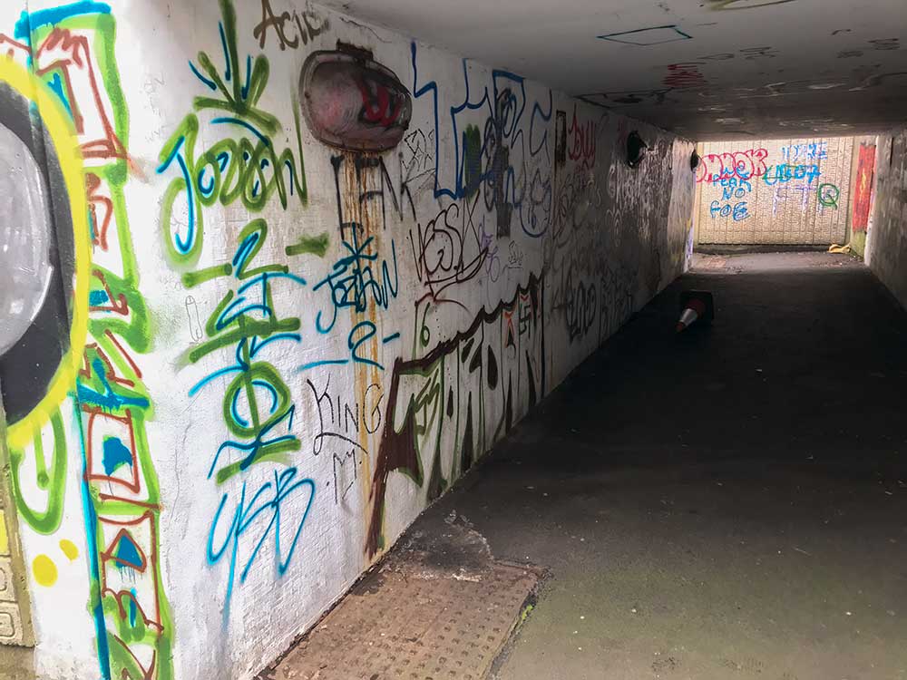
Most of the obvious routes and destinations seem to be covered (but the street names are quite hard to read on all three). A few features don't inspire confidence, such as making a 'main route' of the heavily vandalised Main St (B7012) underpass under the East Kilbride Expressway. Once the networks are finalised, the council should bid for funding to design key routes then progress to construction (as in 3.2, above).
3.4: Dennistoun Community Council – Further update on Spaces for People scheme
Last month, Dennistoun Community Council summarised the Spaces for People project that was put into the area (Digest 88, Item 3.2). This month, Glasgow City Council responded so there's a further Q&A update on the DCC website.
The update also mentions the return of the Dennistoun & Royston Restricted Parking Zone and the new Dennistoun, Riddrie & Carntyne 'Liveable Neighbourhood' proposal. In the last few days, an old proposal has reappeared for a dual carriageway past Alexandra Park, between Dennistoun and Riddrie. So, there should be plenty to talk about in the near future.
