Consultation Digest (Local) Issue 90, 6 July 2021
A mostly North and East, black and white edition of the Digest.
A slightly delayed Digest (due to internet connection issues – apologies). Now with added images.
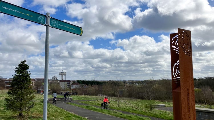
Two significant segregated routes have opened recently in Glasgow – one in the north and one in the east so that's the theme of this Infrastructure Update…
Infrastructure Update (North & East edition)
- It looks like the 1km Garscube Rd cycleway is now open (since a visit by GoBikers Thomas and Calum and recent sensor testing). The landscaping, kerbs and bollards protect bikes from motor traffic between Maryhill and the city centre. Hopefully, it resists car parking too, including matchday parking at Firhill (where two clubs are ground-sharing this season).
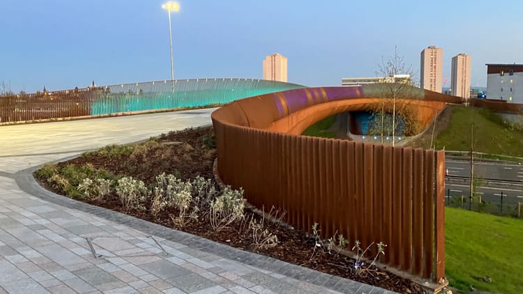
- Nearby, more views of the Garscube Link to canal in progress and its "overlapping blue node aesthetic"!?
- North Canal Bank St is due to re-open to traffic in early July.
- Glasgow City Council posted latest photos of Sighthill's regeneration. No update on the M8 pedestrian/cycle bridge (last we heard, it was due September 2021).
- A different model of secure cycle parking recently installed at Balgrayhill flats.
- Royston Road's 2-way lane now has full size bike traffic lights at Broomfield Rd junction.
- The new phase of the East City Way at Mount Vernon also seems to be fully open. Its 2-way kerb-protected bike lanes link the existing 1-way lanes on Hamilton Rd (Dog's Trust) to London Rd. Two further phases are due to link to M74 junction 2a (Fullarton Rd).
- Clyde Cycle Park breaks ground near Cambuslang, South Lanarkshire. Phase 1 is a small track for road cycling training with further facilities added in future phases.
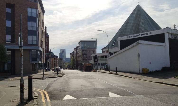
Since the above completely misses out the West End, Southside and most places outside the city, now might be a good time to say the update is always open to photo submissions. Contact us with links or photos, tag us on social media or use the hashtag #GoBikeInfra.
Contents
(new consultations in bold – link jumps to article)
Section 1: Current Consultations
- Glasgow City Council – Burnfield Road (20mph Speed Limit) Order (ends 9 July)
- North Lanarkshire Council – East Airdrie Link Road, Stage 2 survey
- Glasgow City Council – Low Emission Zone consultation (ends 2 Sept)
- Glasgow City Council – Inner East Strategic Development Framework (ends 3 Sept)
- East Dunbartonshire Council – Active Travel Discussion (ends 28 Sept)
Section 2: Forthcoming Consultations
None this time.
Section 3: Consultation Feedback
- Glasgow City Council – London Rd/Spaces for People survey
- NHS Greater Glasgow & Clyde/Sustrans Scotland – Gartnavel Active Travel Feasibility Study
- Glasgow City Council – North Kelvin And North Woodside (Traffic Management And Parking Controls) Order 2021
- Glasgow City Council – Cycling and Walking route beside SEC during COP26
- Multiplex – Glasgow Uni campus newsletter July 2021
- Urban Roots – Malls Mire newsletter June 2021
Section 1: Current Consultations
(in date order for responses)
1.1: Glasgow City Council – Burnfield Road (20mph Speed Limit) Order
This appeared in Digest 89, Item 1.1 about a site near the Glasgow boundary with East Renfrewshire at Thornliebank train station. The order sets a 20mph speed limit for a new housing estate built on a brownfield site. All the usual documents are in the last Digest. The closing date is 9 July 2021.
1.2: North Lanarkshire Council – East Airdrie Link Road, Stage 2 survey
The latest phase of this City Deal trunk road project first appeared in Digest 88, Item 1.6. Stage 2 has a lot of detail about the possible road alignments and the preferred route. These go between Cumbernauld and the Newhouse junction of the M8, via the new Monklands Hospital site at the edge of Airdrie. Sadly, very little detail about the promised active travel routes so far. No detail on a closing date either. See the East Airdrie Link Road, Stage 2 survey to give feedback.
1.3: Glasgow City Council – Low Emission Zone consultation

This consultation is about phase 2 of the Low Emission Zone in Glasgow city centre. Phase 1 only applied to local buses – Phase 2 will include all vehicles entering the zone area (unless exempt). However, it won't apply fully for a while – enforcement is only due to start in June 2023!
See the Glasgow LEZ consultation page and LEZ online survey. Closes on 2 September 2021.
1.4: Glasgow City Council – Inner East Strategic Development Framework
This document is part of a series of long term Strategic Development Frameworks. The most recent of which was for North Glasgow (as featured in Digest 74, Item 1.5). See feedback on the Govan/Partick and River Clyde SDFs in Digest 68, 3.7/3.8.

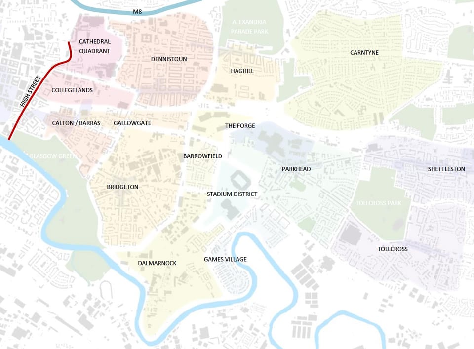
The 'Inner East' apparently covers a large area from High St out to Carntyne and Tollcross, between the River Clyde and the M8. The transport section of the report is chapter 4, part C, 'Connected Inner East'. It mentions several planned/potential cycle routes (and public transport projects). However, some of these were also in the East End Local Development Strategy from back in 2008. Most things that were actually built were for the Commonwealth Games and phase 2 of the East End Regeneration Route dual carriageway. Phase 3 is mentioned in the SDF and the council recently refused to rule out completing EERR.
See the Inner East consultation page for link to the SDF survey.
1.5: East Dunbartonshire Council – Active Travel Discussion
This was in Digest 86, Item 1.2, including its ‘Ideas Map‘ for the area. The latest infrastructure in East Dunbartonshire is a new Bearsway crossing – apparently finished to a much lower standard than the one it replaced.
There are no consultation events just now – the next online ones were due in August/September. See a full list of events and background info on the Active Travel Discussion webpage. Closing date – 28 September 2021.
Section 2: Forthcoming Consultations
None this time.
Section 3: Consultation Feedback
3.1: Glasgow City Council – London Rd/Spaces for People survey
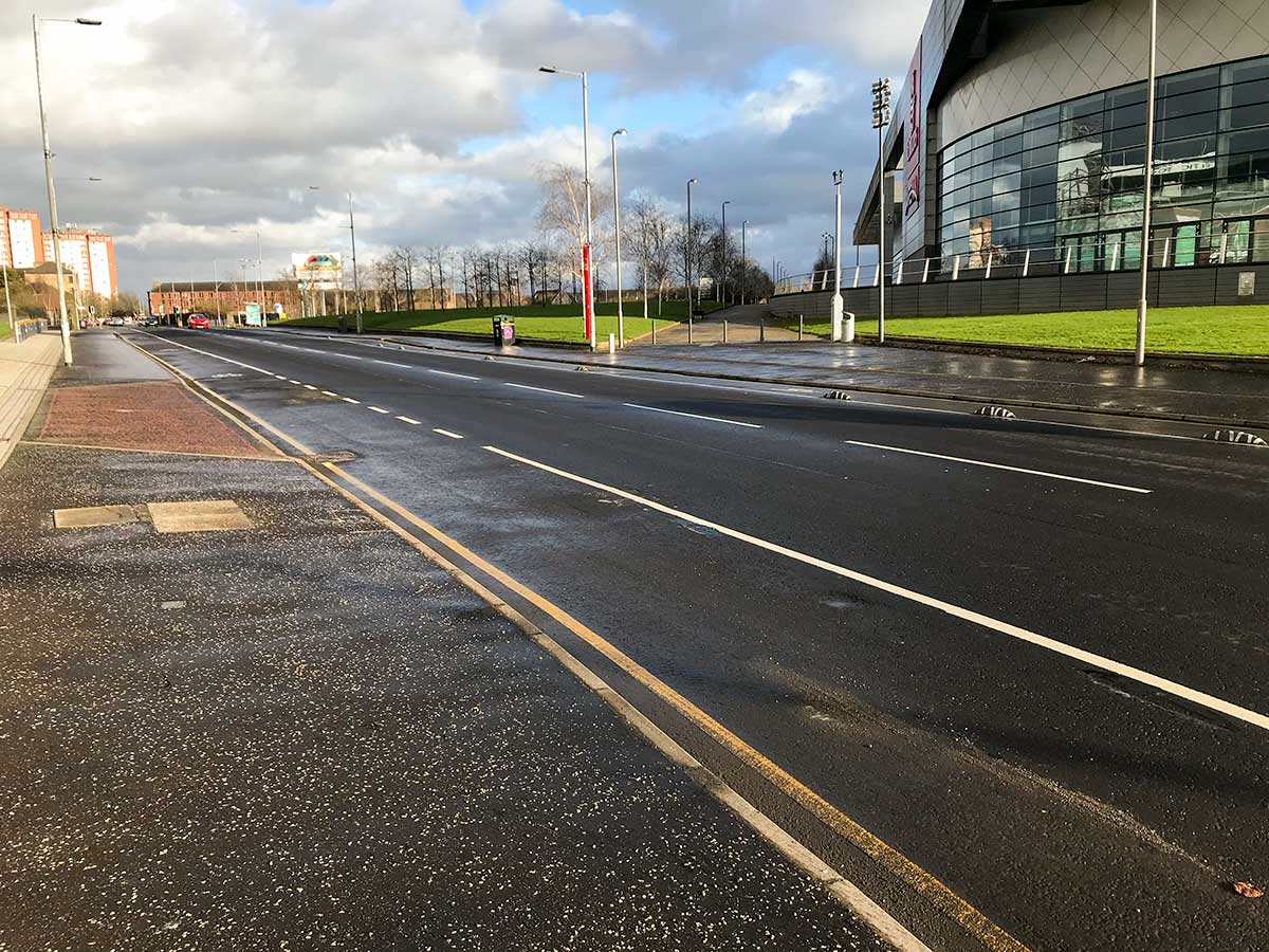
This issue came up in a GCC update about London Rd pop-up lanes and Spaces for People. Restrictions lifting means football fans will probably return to matches shortly, including at Celtic Park, later this month. The council or police have decided the 'zebra' lane separators immediately outside the stadium will be a trip hazard to large football crowds and should be removed.
Many GoBike members were unhappy about the decision and had been discussing how to respond to the announcement. However, it emerged work to remove the separators has already taken place. While 'soft segregation' remains west of Clyde Gateway/EERR and east of Springfield Rd, the block running past the entrances to Celtic Park and its ticket office/club shop will now just be painted lines. Ironically, many of the separators went missing from this area and were replaced a few months ago only to now be removed.
The powers that came with Spaces for People mean GCC doesn't have to consult before making changes. However, the council's own consultation just finished on 20 June (Digest 88, Item 1.3) and results haven't been published yet. The same update said the SfP consultation received over 3,700 responses.
We expect there will be more to say about these in the next Digest.
3.2: NHS Greater Glasgow & Clyde/Sustrans Scotland – Gartnavel Active Travel Feasibility Study
Heading west for this project – we last heard about it back in Digest 60, Item 3.3. It's about access to the site of Gartnavel General Hospital, Gartnavel Royal Hospital and the Beatson West of Scotland Cancer Centre. The idea is to improve connections into the site to help active travel across the wider area. It's focussing on smaller links into and across NHS-owned land, rather than the larger arterial routes nearby (Great Western Rd/Crow Rd).
The project now has consultants on board to look at the Gartnavel hospitals site and paths to nearby Hyndland train station. GoBike member Caroline was involved in an earlier meeting and has met online with the consultant (from ERZ). Following on from the meeting, and discussion on GoBike's Slack group, Caroline sent a response on behalf of GoBike.
A site visit may take place in the near future. We'll keep you posted about any developments.
3.3: Glasgow City Council – North Kelvin And North Woodside (Traffic Management And Parking Controls) Order 2021
This Traffic Regulation Order was apparently made on 10 June 2021 to introduce a Restricted Parking Zone in the North Kelvin and North Woodside areas. There was a consultation back in March 2020 (see Digest 55, Item 1.5) and GoBike had input into the Stage 1 plans before that.
There were minimal changes (moving a few parking bays) so work should start to paint the bays and add signage across the area.
Maps of RPZ area (PDFs):
3.4: Glasgow City Council – Cycling and Walking route beside SEC during COP26
GoBike member Iona has been in touch with GCC about route closures during the COP26 climate conference at the SEC in November. After some emails back and forth we've been told the following:
"I can advise that the alternative routes for active travel will be published for comment on the Get Ready Glasgow website, prior to the statutory process for making temporary orders. Unfortunately, we cannot consult with individual groups prior to the general announcement."
The Get Ready Glasgow COP26 page links to a page on the GCC website with some maps at the foot of it. That's as much as we know for now.
However, we'll try to find out more about closures and report back if we hear.
3.5: Multiplex – Glasgow Uni campus newsletter July 2021
The latest edition from Multiplex/UoG: July 2021 campus newsletter.
3.6: Urban Roots – Malls Mire newsletter June 2021
It's the Malls Mire June newsletter – it may say it's last month but work seems to be progressing well.
